Zebulon Montgomery Pike Trail to the sources of the Mississippi 1805 — 1806


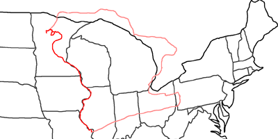
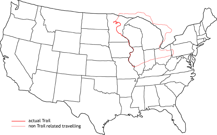
Map of Zebulon Montgomery Pike Trail to the sources of the Mississippi
In 2002 I follow the trail of Zebulon Montgomery Pike, who received the order from president Jefferson to explore the sources of the Mississippi, check out places for possible Forts and announce to trappers, traders and Indians in the north, that Great Britain is no longer in charge of this country, but the USA.
First I travel on Interstates from Pittsburgh to St. Louis. Like Lewis & Clark one year earlier, Pike also started his journey at Camp Wood. On August 9th, 1805, he set off with 20 men and a 60ft keelboat. They had to fight storms and rapids until they had on August 21st the first big council with Indians at nowadays Ft. Madison, Iowa. A murder had happened were Pike was asked for help to clarify. Pike was able to manage the situation diplomatically and they were able to travel on North. Again bad weather and rapids kept up the expedition. On September 1st they reached Dubuque, a town founded by Julien Dubuque. The main income in this area was lead mining. So the government was very interested to know the real amount from the mines for tax purposes. But Mr. Dubuque was able to keep Pike from visiting the mines to discover the real amount of mined lead.
Again the expedition had to fight bad weather. On September 5th, the expedition explored the mouth of the Wisconsin River. They also held councils with different tribes. They went on with smaller boats, until they reached on September 21st St. Paul. The river completely changed here. The water was now clearer and the river bed was getting much narrower. They also held councils in this area.
The weather was getting worse and the rapids more dangerous. On October 16th, the first snow felt. They were in the area of Little Falls, where they fought the rapids. There they built their first winter quarter and they started to build canoes. On October 28th Pike started another try to proceed, but the canoes sunk. So they had to build new ones and they also built sleighs. In the meantime, their provisions were getting low. They also had to hunt for the supply for the next winter months. On December 9th they made another attempt and they passed the rapids. But the weather was getting worse and worse. Sometimes they broke into the river with their sleighs, sometimes the sleighs themselves broke. Eventually they reached Sandy Lake on January 3rd. At the shores a big trader had settled down. From there they started a couple of expeditions to find out the river course and the source of the Mississippi. On February 1st, Pike reached Leech Lake, which he mistook as the source of the Mississippi. But he thought he has completed his mission and prepared for his way back. On April 30th he reached again St. Louis.
I follow the course of the Mississippi to its true sources at Lake Itasca. From there I start my journey back to Pittsburgh, this time along the north shores of Lake Superior and Lake Huron through Canada. At Port Huron I enter the USA again and visit my friends Matt & Jean in Detroit and take the opportunity to see the Henry Ford Museum. The next day I travel back to Pittsburgh.
- Day 0: August 10th, 2002 Munich (Check–In)
- Day 1: August 11th, 2002 Munich — Pittsburgh
- Day 2: August 12th, 2002 Pittsburgh (Get Car from Mine)
- Day 3: August 13th, 2002 Pittsburgh (Dropping Car at Mechanic)
- Day 4: August 14th, 2002 Pittsburgh (Car to Transmission Shop)
- Day 5: August 15th, 2002 Pittsburgh (Transdrive)
- Day 6: August 16th, 2002 Pittsburgh (Transdrive)
- Day 7: August 17th, 2002 Pittsburgh (Transmission Cooler Installation)
- Day 8: August 18th, 2002 Pittsburgh (Rust Work)
- Day 9: August 19th, 2002 Pittsburgh
- Day 10: August 20th, 2002 Pittsburgh
- Day 11: August 21st, 2002 Pittsburgh (Last Preparations)
- Day 12: August 22nd, 2002 Pittsburgh — Terre Haute
- Day 13: August 23rd, 2002 Terre Haute — St. Louis
- Day 14: August 24th, 2002 St. Louis — Hannibal
- Day 15: August 25th, 2002 Hannibal — Quincy
- Day 16: August 26th, 2002 Quincy — Ft. Madison
- Day 17: August 27th, 2002 Ft. Madison — Davenport
- Day 18: August 28th, 2002 Davenport — Dubuque
- Day 19: August 29th, 2002 Dubuque
- Day 20: August 30th, 2002 Dubuque — Cassville
- Day 21: August 31st, 2002 Cassville — Richland Center
- Day 22: September 1st, 2002 Richland Center — Boscobel
- Day 23: September 2nd, 2002 Boscobel — La Crosse
- Day 24: September 3rd, 2002 La Crosse — Winona
- Day 25: September 4th, 2002 Winona
- Day 26: September 5th, 2002 Winona — Minneapolis
- Day 27: September 6th, 2002 Minneapolis — Long Prairie
- Day 28: September 7th, 2002 Long Prairie — Aitkin
- Day 29: September 8th, 2002 Aitkin — Grand Rapids
- Day 30: September 9th, 2002 Grand Rapids — Bemidji
- Day 31: September 10th, 2002 Bemidji (Lake Itasca State Park)
- Day 32: September 11th, 2002 Bemidji — Thunder Bay
- Day 33: September 12th, 2002 Thunder Bay — Wawa
- Day 34: September 13th, 2002 Wawa — Sudbury
- Day 35: September 14th, 2002 Sudbury — Owen Sound
- Day 36: September 15th, 2002 Owen Sound — Detroit
- Day 37: September 16th, 2002 Detroit
- Day 38: September 17th, 2002 Detroit — Pittsburgh
- Day 39: September 18th, 2002 Pittsburgh (Storage Preparations)
- Day 40: September 19th, 2002 Pittsburgh (Mine)
- Day 41: September 20th, 2002 Pittsburgh — Munich
