George Rogers Clark Trail 1778


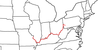
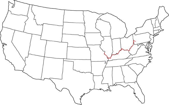
Map of George Rogers Clark Trail
The second part of my trail leads me from Ft. Pitt, nowadays Pittsburgh, along the whole Ohio River to the confluence with the Mississippi. From there I follow the Mississippi up north to St. Louis.
I am following the trail of George Rogers Clarks, who traveled this way at the age of 26 in the year 1778. He had the order to protect the settlers in the formerly Kentucky area from the raids of the Indians. The Indians have formed an alliance with the British, because the British have granted them the land along the Ohio River. But more and more settlers came from Virginia to Kentucky, who became now victimis of the Indian raids.
On December 7th, 1776, Kentucky became part of Virginia County. It took George Rogers Clark until this date to get the government grant him money for his operation. And then it took him again one and a half years until he was able to set off from Pittsbrugh in May 1778. His first objective was to build up two posts along the Ohio to give the settlers enough shelter. As first post he considered the Great Falls of the Ohio. Every vessel had to stop there for a long time and could then be a victim of Indian raids. He built up his post on a small island, which was also suitable for growing corn. That’s why this island was called “Corn Island”. Nowadays this island is gone. One reason is, that around 1800 a vessel accident happened. The other reason is, that there was built up a dam, which raised the water level.
On June 24th, 1778, George Rogers Clark set off again for his journey along the Ohio River. At the confluence with the Tennessee River in the Paducah area he decided not to stay longer on the river. He learned that along the Mississippi spies have been placed to announce every intruder to the British Forts. The spies made the British feel fairly safe, which was there fate.
At the 4th of July 1778 George Rogers Clark and his men conquered Ft. Kaskaskaia at the Mississippi. Because of the long knives his men were wearing, the locals called them “Long Knives”. Two days after the conquer of Kaskaskaia he also conquered Cahokia. Cahokia lays close to St. Louis, which was the Spanish capitol at this time. All the country west of the Mississippi was still Spanish territory.
His next attack was against Ft. Vincennes, which he also conquered. Now he had all important posts under his control and the settlement of the Ohio Valley could begin.
From Cahokia I follow the Mississippi up North to St. Louis, were the third and last part of my trail starts:
Follow me now on my daily trails:
- Day 7: August 27th, 1999 Pittsburgh — Gallipolis
- Day 8: August 28th, 1999 Gallipolis — Cincinnati
- Day 9: August 29th, 1999 Cincinnati — Jeffersonville
- Day 10: August 30th, 1999 Jeffersonville — Evansville
- Day 11: August 31st, 1999 Evansville — Paducah
- Day 12: September 1st, 1999 Paducah — Cape Girardeau
- Day 13: September 2nd, 1999 Cape Girardeau — Chester
- Day 14: September 3rd, 1999 Chester — St. Louis
