Lewis & Clark Trail
Day 35: September 24th, 1999 Dillon — Missoula
Today I will drive up to Lemhi Pass on a dirt road. I hope the weather will be fine. There are already dark clouds in the sky when looking out of the window. After my experiences on the dirt roads I am now more careful. But first it’s time for breakfast. I planned to start around 7am. But it was late yesterday and I wanted to have at least 6 hours sleep. Therefore I start around half past eight to downtown. I saw a nice Café yesterday near my restaurant which has breakfast. So I give it a try. It’s not a fancy restaurant, something were the locals go. And the breakfast has a surprise for me: The Country Potatoes are with the skin. Up to now I didn’t knew that I can eat it. But the breakfast is really great. I leave the Café around eight and drive to the gas station.
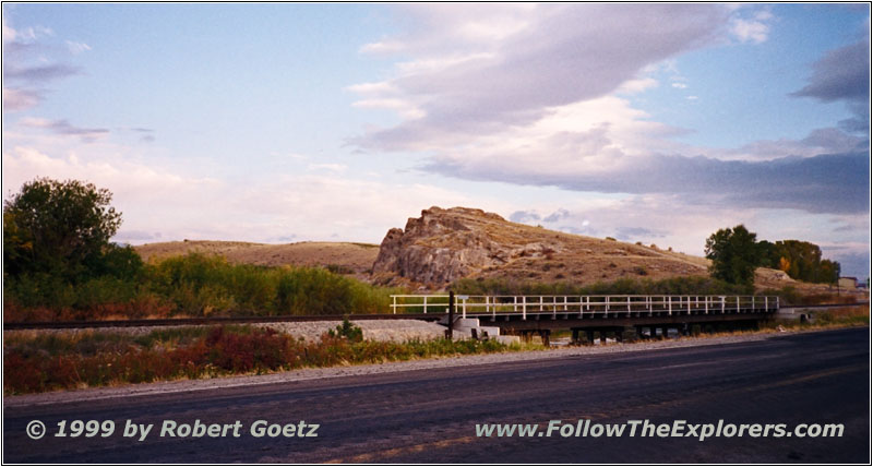
Clark’s Lookout, Dillon, MT
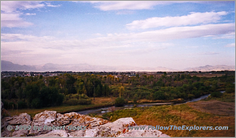
Clark’s Lookout, Dillon, MT
I almost wanted to give up the search for Clark’s Lookout. I already searched for this spot at home but had no luck. But the book I bought in St. Louis describe the hidden path precisely. And with this book I find it without searching. There is no sign showing what histric place is here. This is one of the rare possibilities where you can put your foot exactly in the explorers footsteps. There is also a great view from this little hill over the valley and the mountains on the horizon.
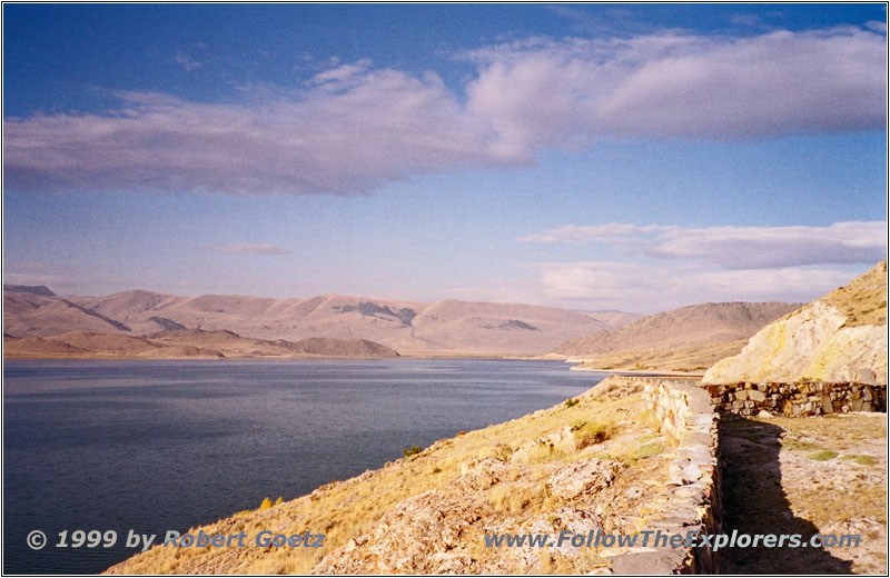
Clark Canyon Reservoir, Fortunate Camp, MT
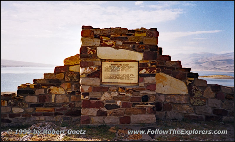
Fortunate Camp, Historical Marker, MT
But I am still concerned about the weather. After I took a couple of pictures I return to my car. I leave around half past eight, already an hour behind my schedule. But I have to enter I–15 anyway as there is no backroad around to drive on. This gives me the chance to gain some time. After 20 miles I reach Exit 44 to Clark Canyon Dam. Now it’s only a short drive to Fortunate Camp Overlook. The Beaverhead separated here once in two unnavigable river streams. Today this area is flooded by the Clark Canyon Reservoir. Only a Historical Marker shows the importance of this place. It was the morning of August 17th, 1805 when Clark saw a group of Indians riding towards his group. He also encountered Drouillard with them. He was in the group with Lewis to find the Shoshone and buy horses for crossing the Rocky Mountains. Clark arrived in time because the Shoshone thought Lewis wanted to trap them. The Indians also wanted to follow the buffalos because the winter was approaching. The only food around here were berries. But the expedition was lucky again: Sacagawea recognized the Shoshone Chief Cameahwait as her brother. Now the distrust was gone and Lewis rode off with the chief and a few Indians to their village to get some horses. The others started to build saddlebags for the Rocky Mountain crossing.
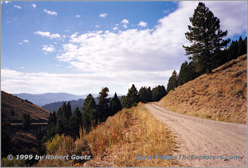
Lemhi Pass Road, MT
I follow Highway 324 to the crossing of RD 300 (also known as Lemhi Pass Road). This road will take me up all the way to Lemhi Pass. It looks like the weather will be ok. I will give it a try. At this crossing was the first time when Lewis met the Shoshone. But the Indians were very cautious and distrusted him. He tried to approach them carefully but they fled. It took a while until he was able to talk to them for the first time.
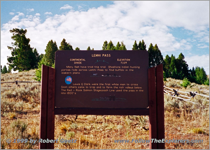
Lemhi Pass, Historical Marker, MT
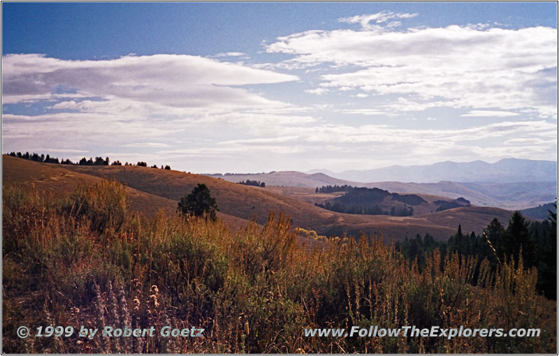
Lemhi Pass, MT
I am driving on RD 300 up to Lemhi Pass. First I pass a couple of farm houses, then the incline to the pass starts. The landscape is really gorgeous. Lemhi Pass is 7373ft high and gives great views of the surrounding mountains. To the north are the mountains with almost no vegetation. To the south are the pines. I am standing here for the first time at the Continental Divide which separates the waters from the Pacific to the Atlantic. In 1805 this was also the boundary of the USA. Today it is the state line to Idaho.
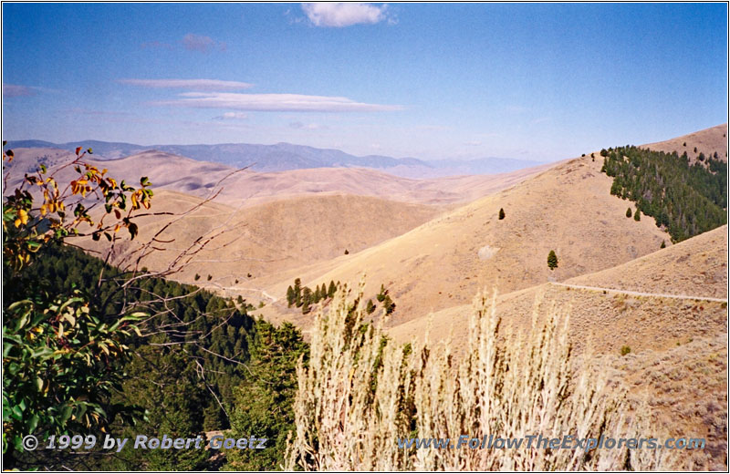
Lewis & Clark Highway, ID
I drive on to Tendoy into the Lemhi valley. This is Sacagawea’s birthplace. I follow Old U.S. 28 to Salmon. Lewis originally hoped to follow the Salmon River. But the Indians told him it is impossible to go there. He tried it anyway but soon had to encounter that they were right. He had to go over Lost Trail Pass and then the Lolo Trail. This is an old Nez Perce Indian Trail.
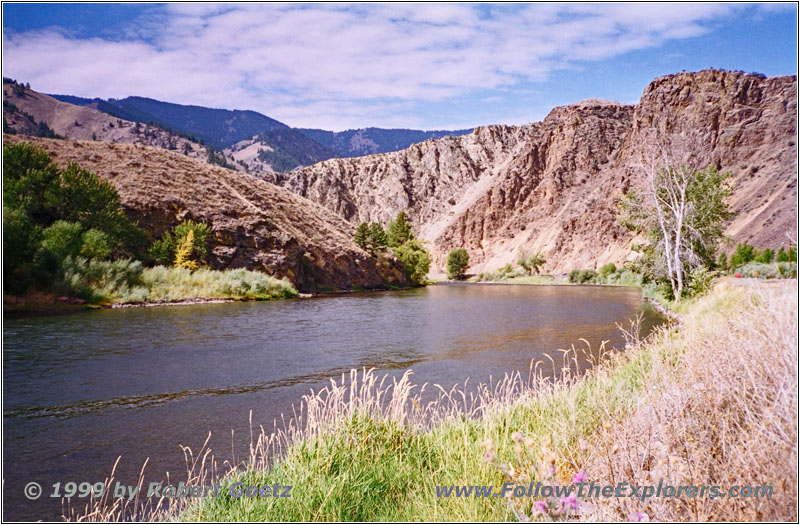
Salmon River, Highway 93, ID
Highway 93 takes me from Salmon to North Fork. I stop at a very beautiful place which overlooks the river. There I meet a couple who spend their lunch time at the river banks. They often stop here with their bike because it is just a nice place to relax. We talked for a while until I have to continue my journey up to Lost Trail Pass. The expedition reached the pass beginning of September. The mountains were almost impassable and they needed a lot of time to proceed. Also the oncoming cold weather put additional hardships on the group.

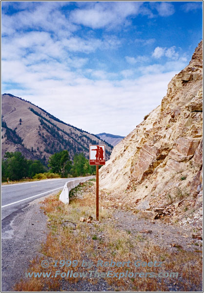
Highway 93, ID
I retrace their steps on Highway 93 to Sula. There they met a group of 400 Flathead Indians. It was difficult to talk to them and they had to set up a five language translation chain. But the Indians understood that Lewis wanted to buy more horsers to cross the Rocky Mountains. In the morning of September 6th both parties separated. The Indians followed the buffalos to the east and the expedition proceeded further to the west.
I follow Highway 93 further on. But after a short distance I have to stop: Traffic jam! In the middle of a free road. After a couple of minutes I am able to proceed and I see why the road was closed: A Pick–Up seems to have underestimated the speed of oncoming traffic while passing. The truck hit the other car frontal. I hope I will not run into the same situation…
Old Darby Road, MT
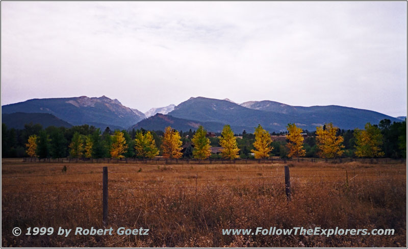
The East Fork, which I followed, and the West Fork unite at Connor to form the Bitterroot River. I follow Highway 93 to Darby. Then I turn onto Old Darby Road which is again a dirt road. This road follows in some areas up on a slope the Bitterroot valley and gives great views of the valley below. At Hamilton I travel on Highway 269. Again I have to pass an accident with a Pick–Up Truck. It looks like the truck was hitting the curve to fast on the wet road and slid to the other side of the road. Seems like everyone is driving like crazy in this area…
At Stevensville I follow Highway 203 to Florence. There I reach Highway 93 again which takes me up to my destination of today: The Motel 6 in Missoula. Around 4pm I am checking in. I am pretty amazed from this Motel 6. It is one of these luxury Motel 6. But it still does not cost more than 40 Dollar.
I still have plenty of time. So I decide to drive into the city and use the opportunity to do some shopping. I hear in the radio a commercial about summer sale in a Western Store. Maybe I have the chance to buy something cheap there. After a while in the store I decide to take a black hat back home. The saleslady is so nice to reshape the hat a bit. It takes here almost half an hour to do the job. This is customer service! She also gives me a hat cleaner for free. Next I look for a nice place for dinner. But I see nothing nice close. there is only a sports club. As I had good experiences in Lewistown I give it a try. But the restaurant is more fast food than restaurant. But I am not in the mood to search more around and I decide to have dinner here. It is not really great but also not too bad. Around eight I leave the Prime Time and return to my motel.
- Sights
- Clark’s Lookout
- Camp Fortunate
- Lemhi Pass
- Lost Trail Pass
- General
- Breakfast: Café, Dillon
- Dinner: Prime Time, Missoula
- Motel: Motel 6, Missoula
- Distance: 258 miles
